On Friday two I got together with two friends of mine for a trip up into the mountains of Miaoli to explore an old Japanese firebase on a promotory overlooking the Ta-an River.
The fun began with a trip to the Taichung HSR station, deliberately reminiscent of an airport, to pick up a friend from Taipei.
The HSR station from the outside.
Patrons buy tickets.
Despite the imposing modernity of the station, a local mother still finds an opportunity to let her kid take a pee next to the Starbucks.
The HSR system, at one time the world's largest BOT project, was designed with the idea that the stations would be located outside cities, to form the seeds of new city centers, and pay for themselves by land leases and concessions.
Inside all is space, steel, and glass.
Arrivals and departures.
We then drove up to Sanyi, the center of the island's woodcarving retailing, and caught 130 over the mountains. Here we stop at a vegetarian lunch box place to grab some lunch.
A street in Sanyi.
Outside of Sanyi the road climbed steeply into the foothills, eventually crossing over at an altitude of 800m and descending down into the river valley of the Ta-an River.
Houses line the narrow road.
We climbed up through some fine Taiwan farmland.
Despite the rapid altitude changes the road is easily accessible to scooters.
Once atop the ridge, wonderful views of the river valley and the mountains beyond...and of course, construction, Taiwan's most important industry.
Our destination looms.
The local farming scenery.
A waterfall beside a field.
After we passed through the small towns in the valley, we turned onto the road into the mountains.
A sterotyped shot. Christianity is common among the aborigines.
Unfortunately, being the driver, I couldn't take many shots of the magnificent mountain scenery -- steep peaks falling into the gorge of the Ta-an River. But I did snap this pic as we entered The National Forest With No Name.
Despite the sharp rise in altitude, from a couple of hundred meters to over 1,000, the road was gentle and accessible to scooters.
It could be a road in northern California.
An hour or so out of the HSR station, we finally reached our destination: the promotory on the left overlooking the Ta-an River.
Hundreds of meters below, the gravel riverbed shines against the green darkness of Taiwan's lush mountains.
1350 meters up, we parked the car next to the road.
Right next to the locked gate of the firebase, the sign gives no indication it is a historic site. A viewing platform and an information center are under construction.
Inside, a small sign indicates the path to the firebase.
Low light conditions in the conifer forest made photography difficult. Here I had to use a flash to bring out a sign that dates back to the 1960s(?).
The government has begun to line the area with railings and stairs. The terrace was created by the Japanese when they built the firebase, however. Walls, rocks, trenches, and the odd bottle are all that remain of the Japanese occupiers.
A forest of conifers -- cedars, I think -- has overgrown the site.
One section of a trench dug from one end of the site to the other.
A close up of the trench. The presence of a long trench suggests that the Japanese expected to be moving about the firebase while being shot at.
Shrooms? Eggs?
The path through the forest.
Could be California....
Winding our way through the forest.
The remains of a wall line one side of a pit. The are several such pits on the site.
Look carefully. A wall can be seen underneath the trees.
The marker indicates the altitude: 1335 meters at this point. Standing here, the view over the mountains and down into the river valley is amazing. From here the Japanese set up artillery and rained shells down on the local people, hoping to either kill them all or force them to move into the river valleys where they could be controlled and assimilated.
The view through the trees.
Another rock wall, photo'd with my flash.
More walls.
More views.
A bridge over the river. Later, returning to Taichung, we would cross this bridge as we followed 61 back to Ta-ken.
In the distance, a dam and reservoir.
Between the poor lighting and the breeze, good flower shots were hard to come by.
"Can we ditch him?" "Nope. He's got the keys to the car."
More flowers.
Still more.
Most of my critter shots failed, but this one came out beautifully.
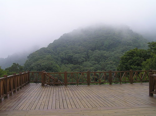
The viewing platform would have offered magnificent views, but the evening fog was rolling in.
Andrew hams it up for the camera.
Near the fort, an abandoned house keeps watch. The road actually continues past this point, but a sign warns that facilities are not finished, and thus, you are strictly forbidden from entering. Translation: you're on your own.
Fruit farms covered the slopes. Andrew pointed out that many aborigine areas are fruit growing areas, since growing rice requires skills and knowledge the aborigines lacked.
Yum.
Great place to live. Too bad there are no jobs.
A local community perched along a ridge above the river.
The road home, wide, flat, full of potholes.
We crossed the river, and stopped to take a few scenery shots.
The bridge.
Gravel riverbeds are an important resource in Taiwan.
Farm and field. A substantial portion of Taiwan's wine grapes come from this area around Tsaotun and northwards.
A dam and reservoir. Just as in the US before 1980, river dams are a sign of progress and pork for the local community.
A house along the river.
Local housing. Think I can get ADSL up here?
Bierstadt does Taiwan.
A local KTV.
Could be a road anywhere in Taiwan.
Civilization manifests itself.
Along the dike, the road is being improved.
Betel nut trees produce addictives for the working class, grape vines addictives for the elites.
Entering Tsaotun town.
Keeping a watchful eye on those foreign irritants in the body politic.
Tsaotun town.
I couldn't get a good pic of it, but Tsaotun town is centered around a square where five roads come together, making neglect of traffic law almost mandatory.
Of course I made a beeline for the drinks stand. That had nothing to do with all the pretty young local girls hanging out there.
The fruit seller.
Dry goods.
Heading home.
The repair shop.
This section of the river is marked by strangely beautiful waterfalls, the brown rocks in the center of the picture.
Bridging the river. 15 kms from Fengyuan, 29 from Taichung. The road back to Taichung took us through
Hsinshe, Dongshih, and Ta-ken.
Before heading back to the HSR to drop off my friend, we enjoyed dinner and beer sales from this stalwart proponent of Budweiser.
[Taiwan] [Japan] [Taichung] [Miaoli]


4 comments:
looks like a very interesting historical place Michael. as always, i enjoyed your photo narrative.
Fantastic post. I feel like I've been there now.
Fantastic narrative! I'm going to try to follow it on Google Earth.
Love your posts Michael! Very vivid and picture-rich. I know theres a load of as yet undisturbed historic sites all over the island, glad to see you make a record of it while its still (mostly) pristine.
Post a Comment